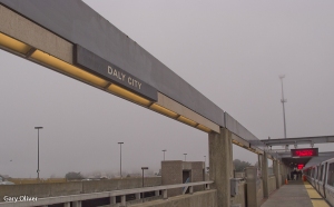
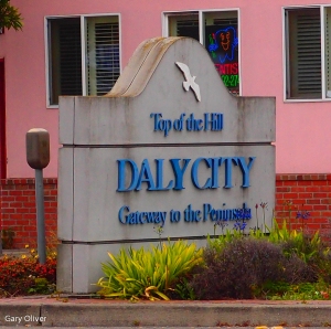
 This week had me hiking the entire length of Mission Street in San Francisco. Starting from the BART (train) station in Daly City, we walked on John Daly Blvd to “Top of the Hill” and from there we turned left onto Mission Street, entering San Francisco in a few blocks. (Note: Clicking on any photo will enlarge it)
About Mission Street (From Wiki): “Mission Street is a north-south arterial thoroughfare in San Francisco that runs from the city’s southern border to its northeast corner. The street and the Mission District through which it runs were named for the Spanish Mission Dolores, several blocks away from the modern route. At 7.2 mi (11.6 km), it is the city’s longest, and one of its oldest streets.”
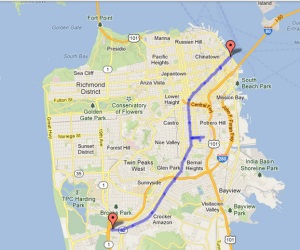 In San Francisco, from the south, Mission Street starts in Daly City and continues north through several neighborhoods, including Crocker-Amazon, Excelsior, Bernal Heights, Outer Mission, Inner Mission, and downtown, and then turns northeast and travels through the South of Market neighborhood before ending at the Embarcadero” which is the boulevard that runs along the Bay.
 The southern half of Mission Street is part of El Camino Real, which connected the missions in California. More about El Camino Real here.
As usual, we made a side-trip: 24th Street and Balmy Alley. More about that here, but with the meandering and side trips, our hike totaled 11.01 miles (17.5km). I have to admit that it was a long hike and one that had so many sensory delights that I feel like I need to be in an isolation chamber for a week to recuperate. I was planning to get a bit poetic with these blog posts, but that will have to wait for another time.
A friend joined me on this hike. As I wrote above, we took the train (BART) from downtown San Francisco to Daly City and began our hike there. From the BART station we walked to Mission Blvd and then walked 68 or so blocks to the end of Mission Street. Mission Street is culturally diverse, but there are pockets of immigrant groups in various neighborhoods.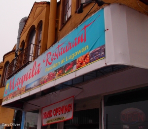
In Daly City, a city of about 100,000 population, Filipinos are the majority in the Asian population along with Vietnamese, Chinese, Burmese and others. Among the Latino population the majority are Mexican and Salvadorian. Mission Street in Daly City is filled with salons, nail parlors, restaurants and Filipino groceries.
Continuing along Mission Street and entering San Francisco, the flavor of the neighborhood changes from strongly Filipino to more of a mix of Asian cultures and we begin to see Salvadorian establishments. We did find a fish sauce store, but it seems to be long closed.
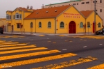
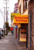
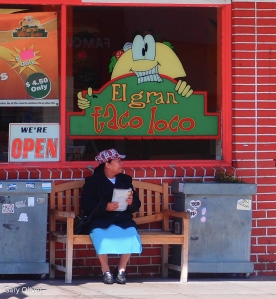
In the outer Mission, there are almost as many storefront churches as there are nail parlors and ‘beauty salons.’ There are many colorful houses, business and signs, and the smells of the many bakeries and restaurants made it difficult to continue with the walk – I wanted to stop and sample the foods at least once on each block.
We saw many interesting places and I shot so many photos that the all can’t fit here. I was surprised to find out that the Excelsior neighborhood was primarily an Italian, Irish and Swiss community. There are still Italians living there. Initially, it was a community of Ligurian farmers. But after the 1906 earthquake, many Italians moved there, including many from Cosenza (Calabria) Italy.
There are bright colors everywhere you look and yet it is visually pleasing and very tranquil:
We made a side trip on 24th Street, which is even more colorful than Mission Street. Connecting with 24th Street there is Balmy Alley, which is known for the fantastic murals painted on the sides of buildings:
 Of course, all along Mission Street there are many bars, clubs and liquor stores. Here is a sampling:
And there are a lot of bakeries, restaurants and grocery stores too:
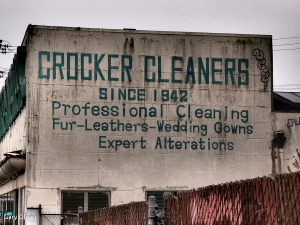
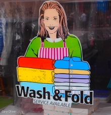
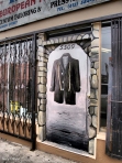
There are other businesses as well:
And finally, we finished at the foot of Mission Street, at the Embarcadero. It was a wonderful urban hike. I will do it again, sometime soon. –Gary


